⇨ See the Summary of the Environment


⇨ See the Summary of the Performances
⇨ See the Summary of the Environment


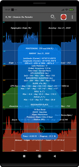
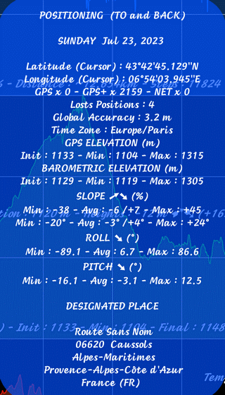
⇨ TITLE OF DISPLAY (Kind of Track)
Simple Track ST (ONE WAY)
Compound Track CT (TO and BACK)
Compound Track CT (TO) or Compound Track CT (BACK)
⇨ DATE
Week Day and Date
⇨ LOCALIZATION DATA
Latitude at the Cursor (D:M:S:Thousandth) & Cardinal
Longitude at the Cursor (D:M:S:Thousandth) & Cardinal
Number of Localizations with GPS x Occurrences
Number of Localizations with GPS+ x Occurrences
Number of Localizations with NETwork x Occurrences
Total Number of Lost Positions
Global Localization Accuracy (meters & Tenth)
Geographical Area for Local Time
⇨ GPS ELEVATION (m)
Initial, Average and Maximum Elevation
⇨ BAROMETRIC ELEVATION (m)
Initial, Average and Maximum Elevation
⇨ TOPOGRAPHIC SLOPE (%)
Extreme Minimum, Negative Average/ Positive Average and Extreme Maximum
⇨ ROLL ANGLE (°)
Minimum Value; Average Value; Maximum Value
It is the Device maintaining Angle Left/Right according to a Lateral Axis
⇨ PITCH ANGLE (°)
Minimum Value; Average Value; Maximum Value
It is the Device maintaining Angle Backward/Forward according to a Longitudinal Axis
⇨ DESIGNATED PLACE
Adress or Place Name
City Name or Locality
Sub-Administrative Area
Administrative Area
Country and Country Code
⇨ Activate this Function with the ❏ (PERF/POS/ENV) Menu
⇨ Touch the Window to Change the Data Display
⇨ Light OFF the Analysis Window with the BACK Control (↶ )
⇨ Or Touch the Screen Outside of this Window
⇨ Or Long Touch on the Window
We can understand, reading the Text below, the Interest to Elaborate a Compound Track (CT)
⇨ Select TO and BACK and Compare, separately, the Performances
⇨ Case of TO/BACK with a Compound Track (CT - WAY TO and BACK)
Statistics Data are merged WAY TO with WAY BACK
⇨ WAY TO Case in Compound Track (CT - WAY TO)
The Statistics are calculated from WAY TO Track
⇨ WAY BACK Case with Compound Track (CT - WAY BACK)
The Statistics are calculated from WAY BACK Track
⇨ Case of Simple Track (ST)
The Statistics are, of Course, Global
Top of Page