⇨ Build a Virtual Route in Order
to know the Characteristics (Distance, Duration of the Route, Direction...)
⇨ Being able to Find the Starting Point
⇨ Being able to Be Guided in Point to Point Mode on Site
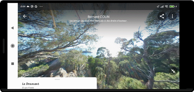
⇨ Discover and Build a Panoramas Collection
⇨ Find the Starting Point of the Route on the Map
⇨ Press long the Screen and Hold on to initialize the First Position
⇨ Then Press long, to draw the following Positions
⇨ Choose the best value of the Map Zoom
⇨ Each Time you Press the Screen, there are displayed :
the Position Number
the Total Distance
the Distance from the Previous Position
the Total Time From the beginning
the Azimuth (Direction of the Walk)
⇨ At any time, the Process may be interrupted
⇨ to Exit, use the RETURN Key (↶ )
⇨ To return to the Virtualizer Process, press "BUILD a Virtual Track" Command
⇨ The Virtual Route is now displayed :
The new Initial Marker is Red
The new Final Marker is Blue
⇨ Continue the Process until the End of the Route
⇨ To delete the last Position, Press briefly on it :
a Label appears
Press this Label for a long Time :
the last Position will be deleted
⇨ if you Press on another Position than the Last One
a Short Press on that Label allows to know more
a Long Press on that Label triggers the Search of Panorama
a Soft Press on the Map is to know the Mode (TRACK or PANORAMA)
⇨ If you want to know the Elevation at each Position :
Select a Position
Wait for the Appearance of the Label
Call "ACTION BAR MENU" : "Get the Elevation"
Choose the Method : INTERNET REQUEST or USING KEYBOARD
Repeat the Operation as many times as necessary
⇨ Check Details at each Point :
Distance, Mapping Positions, Time, Azimuth, Elevation, Locality Details
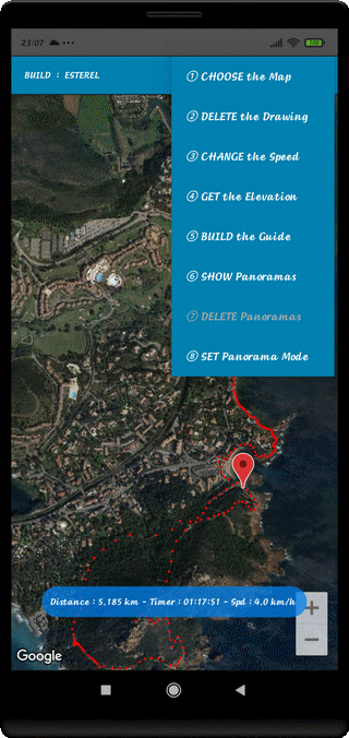
⇨ ① CHOOSE the Map
Hybrid Mode
Plan Mode
Satellite Mode
⇨ ② DELETE the Drawing
Delete the Totality of the visible Route and Initialize another One
⇨ ③ CHANGE the Speed
Allow to Modify the Average Horizontal Moving Speed in km/h
⇨ ④ GET the Elevation
Allow the Initialization of the Elevation of each Position by an INTERNET REQUEST or Manual Input
⇨ ⑤ BUILD the Guide
This Track, then, appears in the list of Titles with the ∞ Termination
You have to Choose Simple Track (OW) or Compound Track (TW : TO + BK)
The Starting Point Finding Function is also possible
The Point-to-Point Guiding Function is also possible as
soon as you are on the Site, at the Starting Point
⇨ ⑥ SHOW/HIDE Panoramas
DISPLAY or HIDE the Blue Panorama Markers
⇨ ⑦ DELETE Panoramas
In PANORAMA Mode, allow to Delete the Selected Panorama or all Panoramas
⇨ ⑧ SET Panorama/Track Mode
Allow the Choice of TRACK or PANORAMA Modes
⇨ ⑨ Touch Application Icon on Action Bar Menu
Detailed Display of Explanations from the Support Site
⇨ Before pressing "BUILD a Virtual Track" Menu
Don't forget to choose the Area
⇨ To improve the Distance Accuracy
Decrease the Interval between the Positions in the Bends
⇨ To improve the Guidance
Observe the Equidistance between the Positions